
download pdf (7.6mb) / see .jpg (1.4mb)
This is our official 9 folds A1 format, 2012hopes.com + international-ocean-station.org threat nd concept map, beta 01.
It is creative commons It combines :
- high human density
- responsivness to pandemics
- recent violent conflicts
- maritime piracy
- hypothetical nuclear fallouts (from civilian power plants, based on the footprint of Chernobyl)
- high sea pollution
- sea level rise endangered land
- pole shift hypothesis location
- tsunami risk exposure
- earthquakes
- cold sea
- cold land
- intense sea wind
- low biomass, low chlorophyll
- a grayscale composite of all these maps

download pdf (11.6mb) / see .jpg (2.6mb)
You can download both maps in both .pdf and .jpg in a .zip file (21mb).
This concept map explains how we researched originally about 2012 and how the project transformed into a sea steading project.
These 2 maps will answer :
- where on earth are we less exposed to threats.
- what we are interested in, and where our research is going.
Following is the text on the map :These maps were made by Martin Gautron, Cesar Harada and Hiromi Ozaki.
Open Sailing
The best way to predict our future is to invent it.
Open Sailing aims to design and invent future lifestyles to overcome any possible natural and manmade disasters stimulating people's ingenuity and sense of solidarity. Might it be global warming or energy conflicts, we are living in a time where we are sniffing the 'Apocalypse', finally realising our human part of responsibility as the earth is crumbling. 2012 is a year when a collection of apocalyptic events are rumored to happen. We are taking 2012 as an ideal dystopic symbol we design for. 2012 is tomorrow, we must design quickly using these constraints and invent bootstrapping DIY technologies.
Open Sailing method is to convert apocalyptic threats into design constraints. From our compiled set of threat maps, we found that oceans are the safest locations. Ocean survival architecture became our new starting point, but we need to go further than surviving : how can we live together in this new fluid configuration and remain a hyper-connected intelligent social being? We are trying to make a truly "open architecture" : pre-broken, under-defined, reconfigurable, moveable, pluggable, organic, fluid. Can we reach a harmonious dynamic state of interdependence with each other and the earth? Is this the next step of civilization progress? Will we dissociate our concept of progress with infrastructure and metropolis?
NEXT STEPS IN 2009
Finding motivated knowledgeable collaborators and funders (february).
Prototyping technology equipment for ocean living, UK (march ~ april).
Testing the Open Sailing in the Atlantic ocean, Morocco (may).
Public presentation of Open Sailing researches (june)
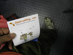
The map folded, coming out of my pocket,
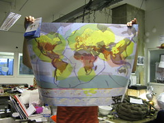
the map on the world map side (on the other side, it is the concept map).
If you want to have a map just send us an email, we’ll arrange.

No comments:
Post a Comment
Please leave us comments, ideas, remarks, inspirations ...